get the lay of your land
Professional Surveying With Precision You Can Trust.
At James J. Pittman PLS PLLC, we provide reliable land surveying services throughout Western North Carolina, East Tennessee, South Carolina, Alabama and Georgia. Whether you're purchasing property, preparing to build, defining boundaries, or planning a development, we deliver accurate results you can depend on.

Our Surveying services
-
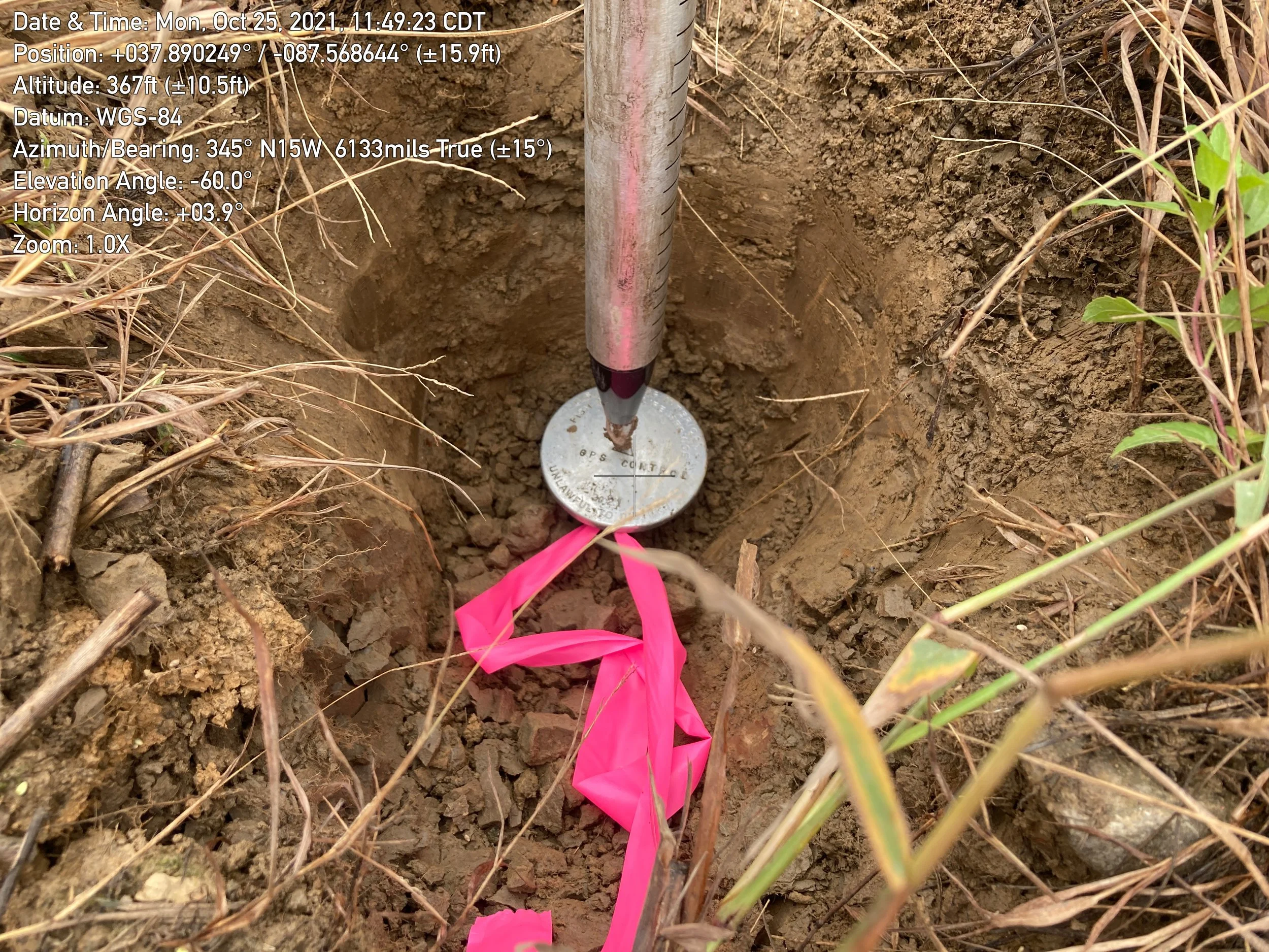
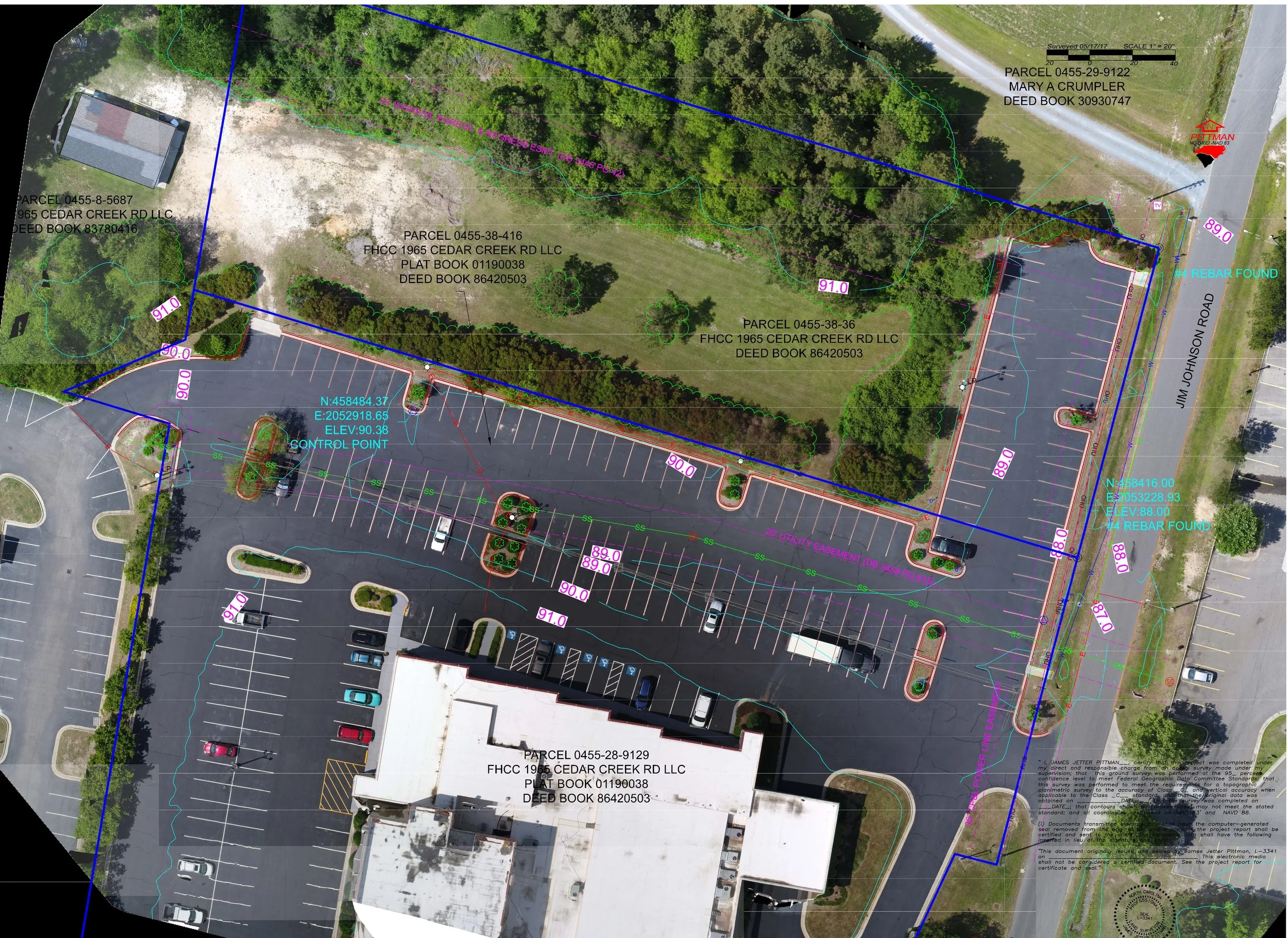
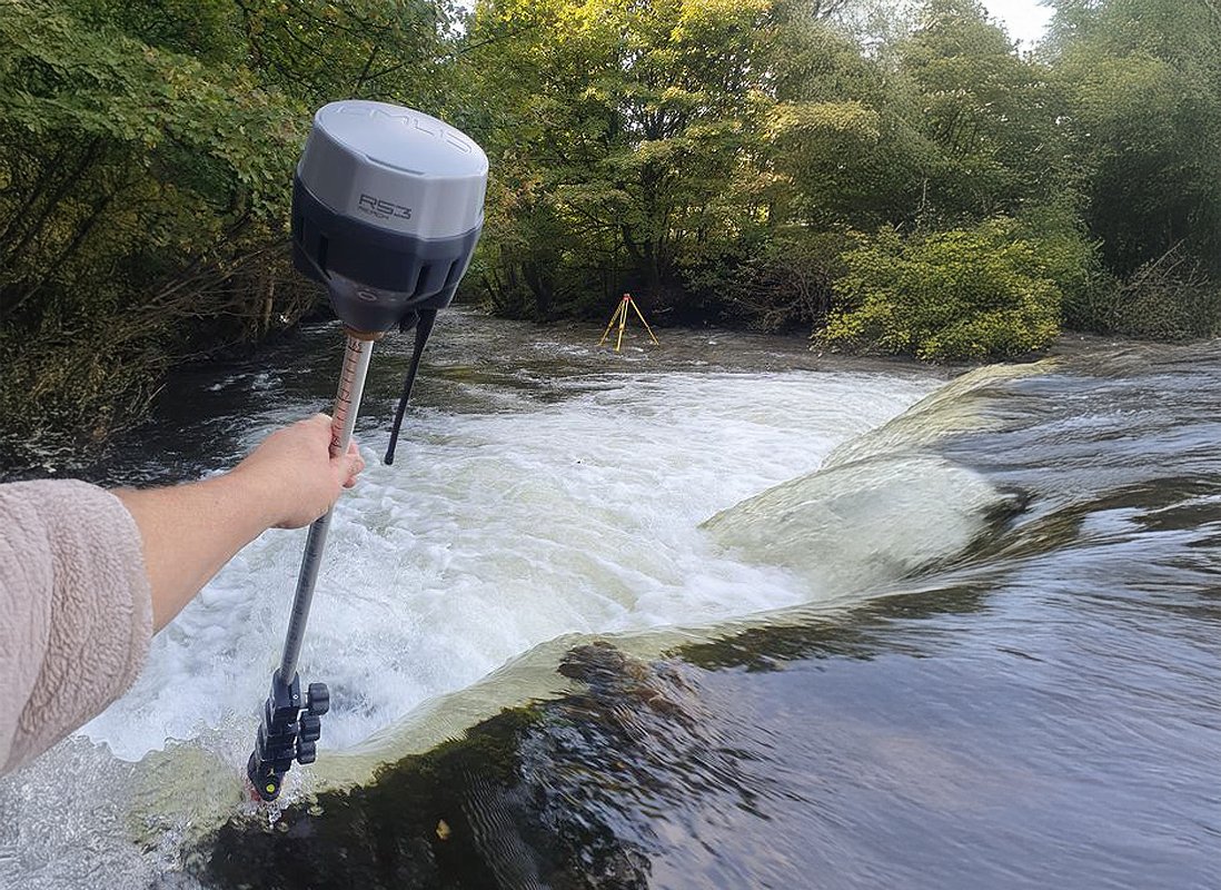
Boundary surveys
We provide ALTA/NSPS land boundary surveys that eliminate uncertainty, prevent disputes, and deliver accurate, compliant documentation for confident planning.
-
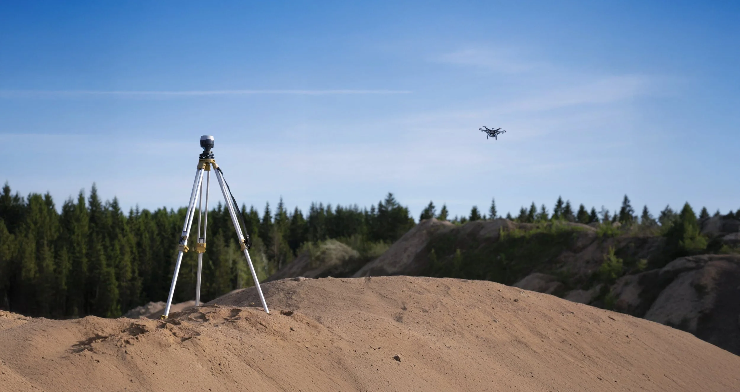
drone surveys
Drone surveying uses UAVs to capture high-resolution geospatial data for mapping and analysis, providing faster, safer, and more cost-effective results than traditional methods.
-
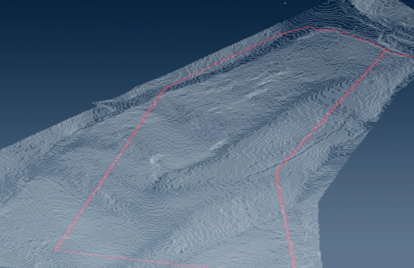
lidar contour overlays
We provide high-resolution USGS LiDAR contour overlays from bare-earth DEMs, delivering accurate elevation data that supports efficient planning, better infrastructure, and broad industry use.
-
Elevation Certification
Our Elevation Certification surveys deliver verified elevation data for insurance, permitting, and floodplain compliance.
-
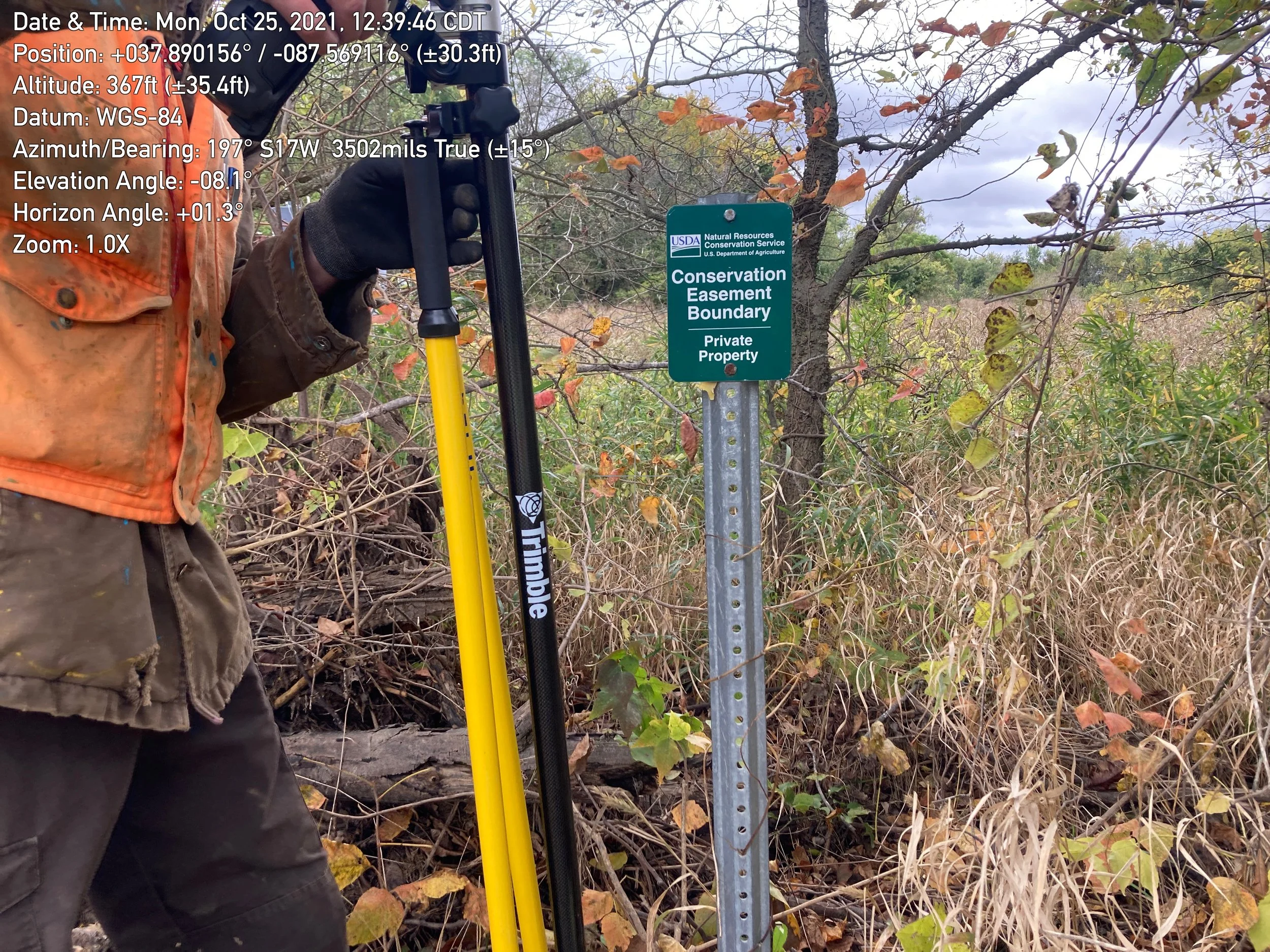
Conservation Easement
Our Conservation Easement surveys document and map protected areas to ensure compliance and long-term land stewardship.

About
our company
Mr. Pittman began his surveying career in 1983 in Raleigh, North Carolina, working with private firms as well as the North Carolina Department of Transportation and the U.S. Fish and Wildlife Service. With decades of experience, our team offers a full range of surveying services, including Boundary, Topographic, ALTA/ACSM Land Title Surveys, GPS Surveys, As-Builts, Utility Easements, Flood Certifications, Drone Surveys and Lidar overlays
We use modern, industry-leading equipment in both the field and the office. All field data is digitally collected and processed in a Carlson IntelliCAD environment. Our tools include Carlson data collectors, survey-grade GPS stations, GeoMax robotic total stations, and DJI drones.